Selly Oak New Road Proposals
posted by James Thornett
According to birmingham.gov.uk, construction on the Selly Oak New Road is about to start. The 'last updated' tag on the page says 2nd October 2007 although this doesn't necessarily mean that the information is completely new.
According to the website
Anyone able to shed any light on when construction is actually due to start?
Please comment on this post if you have any additional info...
There's a useful map of the proposed new road on the website, although I've provided a slightly doctored version below to make it, I think, a bit clearer.
The orange line is the current Bristol Rd through Selly Oak, the red line is the proposed new road. The heavily student-populated area including Dawlish Rd, Tiverton Rd et al is the large area shaded green in the centre.

(click on map for large version)
In essence the reason behind the plan is very similar to the Northfield Relief Road which was completed in June this year and allows traffic to progress along the A38 route between the city centre and Rubery/M5 without going through the busy shopping centre of Northfield.
The idea of diverting traffic away from the pedestrian-busy shops/pubs of Selly Oak and allowing heavy traffic a quicker and easier access in/out of the city has been around for some time with many of the details agreed in 2004.
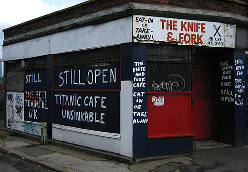 The recent demise of the Knife and Fork (pictured left) was, for many, the first big step in the plan.
The plans for the new road are part of a wider initiative labelled the Selly Oak Local Action Plan which includes a number of other major developments in the area.
According to the website
Works are programmed to start in October and last for 10 months until August 2008.Has anyone else got any further information on this?
Anyone able to shed any light on when construction is actually due to start?
Please comment on this post if you have any additional info...
There's a useful map of the proposed new road on the website, although I've provided a slightly doctored version below to make it, I think, a bit clearer.
The orange line is the current Bristol Rd through Selly Oak, the red line is the proposed new road. The heavily student-populated area including Dawlish Rd, Tiverton Rd et al is the large area shaded green in the centre.

(click on map for large version)
In essence the reason behind the plan is very similar to the Northfield Relief Road which was completed in June this year and allows traffic to progress along the A38 route between the city centre and Rubery/M5 without going through the busy shopping centre of Northfield.
The idea of diverting traffic away from the pedestrian-busy shops/pubs of Selly Oak and allowing heavy traffic a quicker and easier access in/out of the city has been around for some time with many of the details agreed in 2004.
The recent demise of the Knife and Fork (pictured left) was, for many, the first big step in the plan.The plans for the new road are part of a wider initiative labelled the Selly Oak Local Action Plan which includes a number of other major developments in the area.
Labels: news, road, sellyoaknewroad, transport

 B29 Links


0 Comments:
Post a Comment
Subscribe to Post Comments [Atom]
<< Home