Latest flood missive from BCC
posted by pindec
Another month, another City Council missive about the floods back in September 08 ... This time it's to feedback about the (paper) questionnaires they sent round and to let everyone know they are Doing Stuff.
Interestingly, they are also asking if it's OK if they share the result of their investigation into the causes of the flood with the Environment Agency and Severn Trent Water ... this seems to (a) be a no-brainer and (b) imply that the various agencies still can't work together - at the community meeting the Council organised shortly after the floods, it was clear that the agencies didn't really have a model for communicating, and there was a certain amount of shifting responsibility round on each other.
If your house is filling up with sewage water, you don't really care which agency has responsibility. It transpired that Severn Trent didn't even realise the flooding was contaminated with sewage until the community meeting - and again it doesn't take a genius to realise that if you have a holding tank of sewage under Dog Poo Lane, and there's a massive flood on the lane, there might be some kind of unpleasant leakage going on.
Nevertheless, we now have a useful list of numbers (including out of hours) for BCC flooding - though it's still split between "blocked highway drainage flooding" and "river flooding", plus EA's floodline, Severn Trent and Flood Forum - which is still a lot of numbers to choose from if you're not entirely sure where the water's coming from.
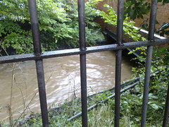
In September, Bournbrook burst its banks because it couldn't fit under the road at Pebble Mill, and submerged Sir John's, 4th and 3rd Avenues - does that count as river flooding or poor drainage or Severn Trent or EA's problem? EA says it doesn't deal with surface flooding (and had no flood alerts up about B29 at the time) - and the Council don't seem to have plans in place to deal with incidents where the Bournbrook is too fat to fit under the road.
Still, this incident has incited the most contact we've ever had from any local governmental type agency, other than the time the Lib Dems came round to see if we wanted anything ... and of course the flood of semi-interested activists at local election time. Though I still reckon we've had the Jehovah's Witnesses round more often than any political bunnies - and they even claimed it was nice talking to me last time after I (politely) declined The Watchtower on account of being a committed atheist.
FYI the flooding contact details in full:
BCC Highways (blocked drainage) 303 6644
BCC river flooding: 303 7235
Out of hours for both: 303 4149
EA floodline: 0845 988 1188
Severn Trent: 0800 783 4444
Flood Forum: 01299 403055
Labels: b29, floods, local government



 B29 Links



